
Application of GeoAI technology in rare earth mineral assessment
05/02/2025TN&MTAt the beginning of 2025, a series of new regulations on the technical investigation, resource assessment, and exploration of rare earth minerals and marine sand deposits will come into effect.
According to Circular No. 21/2024/TT-BTNMT, which stipulates the technical guidelines for the investigation, resource assessment, and exploration of rare earth minerals, GeoAI technology utilizes artificial intelligence algorithms for the integration and analysis of geological data.
This technology is encouraged for use throughout the entire process of rare earth mineral resource assessment. The general requirements for applying GeoAI technology are as follows: AI models must ensure the security of original geological data. Input data should include geological structures, geological cross-sections, geochemical and geophysical data, drilling operations, mineral deposit locations, hydrogeological and environmental data, and other relevant information as needed. Additionally, the reliability of the GeoAI application results must be thoroughly evaluated.
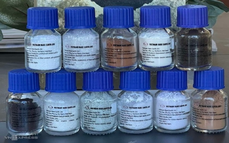
17 rare earth elements separated by Vietnam Rare Earth Joint Stock Company
Rare earth elements (REEs) comprise a group of 17 elements: Lanthanum (La), Cerium (Ce), Praseodymium (Pr), Neodymium (Nd), Promethium (Pm), Samarium (Sm), Europium (Eu), Gadolinium (Gd), Terbium (Tb), Dysprosium (Dy), Holmium (Ho), Erbium (Er), Thulium (Tm), Ytterbium (Yb), Lutetium (Lu), Scandium (Sc), and Yttrium (Y). Primary rare earth minerals are those in which REEs exist within mineral structures, while ion-adsorption rare earth minerals are those in which REEs exist as adsorbed ions on the surface of clay minerals in weathered crusts.
As outlined in Circular No. 21/2024/TT-BTNMT, the assessment of rare earth minerals includes: collecting, synthesizing, processing, and analyzing acquired data; formulating and determining the network, methods, and volume of work items necessary for rare earth mineral assessment; and geodetic operations supporting geological, geophysical, and excavation drilling activities.
The field survey follows a systematic approach, incorporating ground gamma-ray spectrometry and gamma-ray spectral measurements in selected prospective rare earth-bearing areas. Borehole gamma logging, core sample gamma measurements, and geophysical borehole logging are conducted to delineate the scale and size of rare earth ore bodies within excavation projects, locate ore bodies in boreholes, and determine sampling points for analysis.
Excavation works—including outcrops, pits, trenches, and shafts—are conducted alongside drilling operations. Samples from excavation and drilling sites are collected and analyzed to determine rare earth content, along with the collection and examination of technical samples. The hydrogeological and geotechnical characteristics of rock formations in the assessment area are identified.
The collected data and analysis results are synthesized to delineate the distribution of rare earth mineral deposits that meet resource estimation criteria and to identify regions suitable for further exploration. Environmental geological assessments are also conducted as part of the process.
PV
Post Related

Linking policy, technology, and markets to strengthen regional cooperation for green agricultural value chains
Promoting trade and investment between Vietnam and the state of Iowa

Coffee by-products: Unlocking new value from an overlooked resource

Science, technology, and innovation: The foundation for doubling productivity and increasing product value
Vietnam and Malaysia strengthen cooperation in agriculture, fisheries, and food security
Viet Nam promotes the role of communities in economic development linked with environmental protection
Partnering for a green future: The World Bank’s support for sustainable agriculture in Viet Nam

Vietnam’s agrifood momentum: Progress, partnerships, and a sustainable path forward